eBirders who enter checklists via the app automatically create an eBird Mobile Track that is attached to the checklist, though it is apparently only visible to the checklist submitter. The track appears in the upper left corner of the online checklist, and it has intrigued me since it started appearing.
I recently birded the Tualatin River NWR near Portland, Oregon, and made that my test case for a deeper dive into the Mobile Track. The refuge is a popular birding location, and it has 229 species observed and nearly 8,000 checklists submitted. The refuge is supported by an active non-profit (Friends of Tualatin River NWR) and it has an busy educational calendar.
Initially, eBird allows you to make the map full screen and zoom in to show the track itself or zoom out to show the surrounding landscape. I always find it interesting to get a bird’s eye view, as the broader picture is lost on the land-bound. The image below shows Tualatin River NWR (the blue and white dot in the lower left corner) relative to the Portland Metropolitan Area, which has a population of approximately 2.5 million. A Google Maps image is below that, for those unfamiliar with the area.
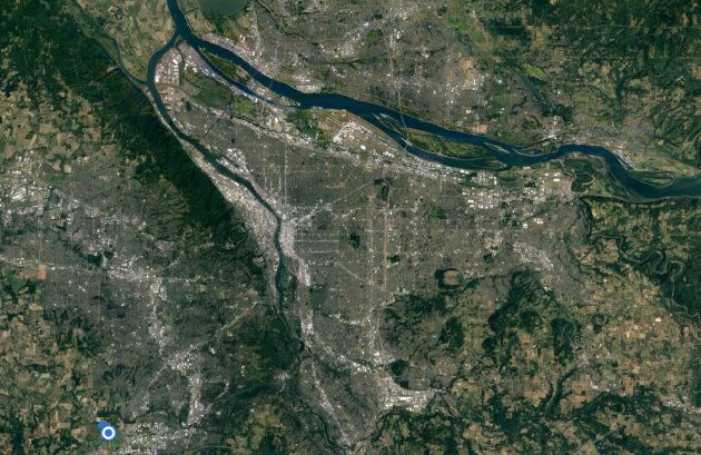
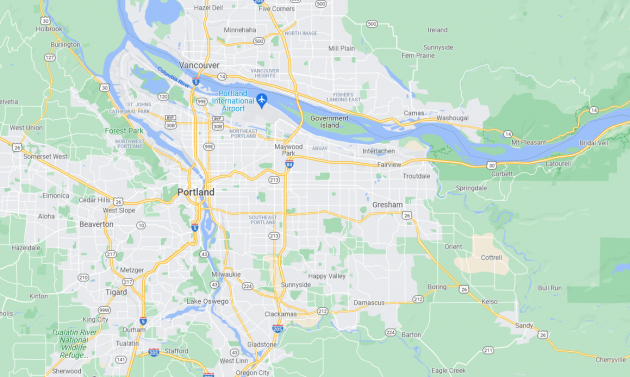
The river at the top is the Columbia, which forms much of the border between Oregon and Washington. The Willamette flows into the Columbia at the top left, and Portland straddles the Willamette. Downtown Portland is the lighter area along the river, slightly to the left of the middle of the image. Tualatin River NWR is about 15 miles from downtown Portland, and it qualifies as an Urban NWR. The refuge is in the midst of an ambitious restoration.
The image below zooms in on the refuge and its immediate surroundings. The refuge is located at the outer edge of the metropolitan area, but is is very close to a heavily urbanized area.
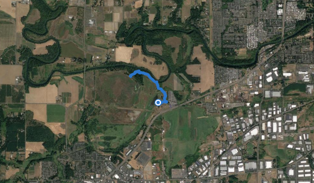
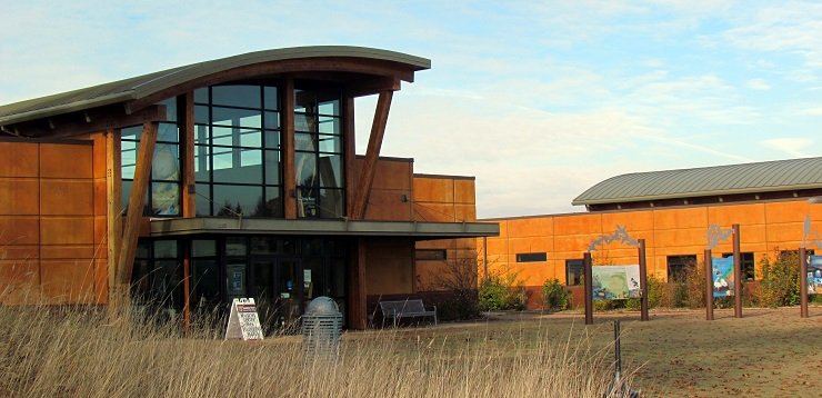
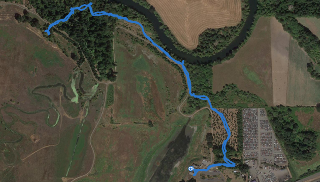
Below is a more detailed image of the track, which starts at the impressive visitor center (pictured at the top), goes through a small grove of Oregon White Oaks, winds along the namesake river and into a wooded area, and ends at the overlook. During the winter, the various seasonal trials are closed for wintering waterfowl and the primary trail is this out-and-back. The meanderings and backtracks in the wooded area were looking at groups of Black-capped and Chestnut-backed Chickadees, Ruby and Golden-crowned Kinglets, etc. The eBird checklist is here.
Below is an even more detailed view of the beginning of the track, starting at the parking lot and visitor center, which overlooks a seasonal marsh, and down past the restrooms and onto the trail. The building on the top left is the FWS HQ and the building below it is the visitor center, which has a store, displays, and some classrooms, though it is currently closed due to the pandemic.
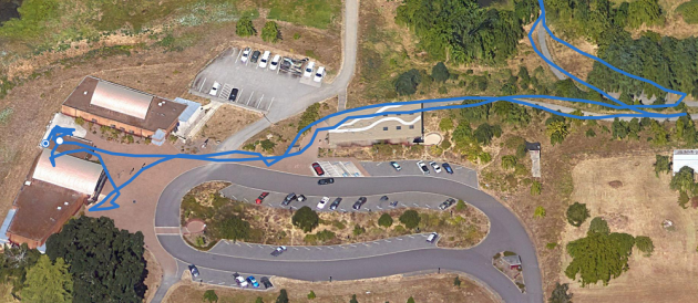
The track itself is quite accurate, seemingly to within a few yards. I didn’t actually climb onto the roof of the visitor center, but I did go back and forth along the platform that overlooks the marsh, checking the various waterfowl. (During winter, the refuge is full of noisy Cackling Geese.) I stayed on the trail even though the track makes it look like I wandered off it. But I still consider that impressive accuracy.
The Mobile Tracks are a nice addition to eBird, as they provide a unique perspective on each birding trip and the ability to put the birding location in a larger context. It is unclear to me why the track cannot be voluntarily shared (I understand why sharing is not the default). eBird keeps improving, and it the additional features consistently add to the birding experience.





Leave a Comment